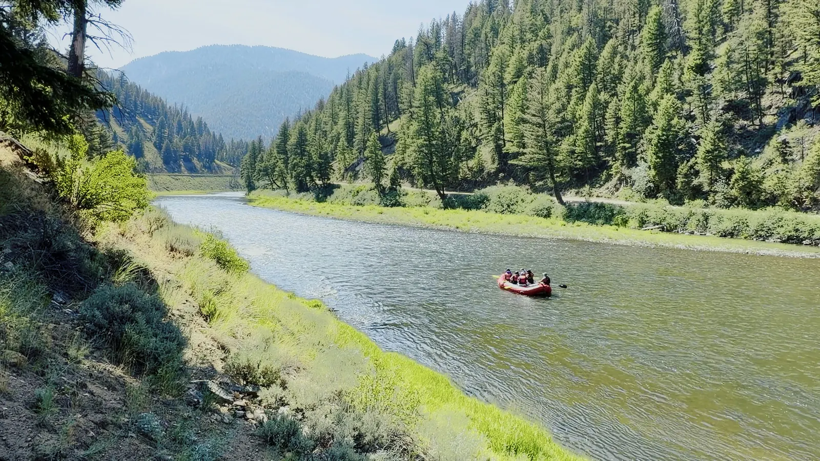
Rafters on the Salmon River below Stanley, Idaho, July 2026.
The Salmon River, every rafting section from Stanley to the Snake
The Salmon is one river with many trips on it. From Stanley it runs north past Challis and Salmon, turns west at North Fork into a mile-deep canyon, takes in the Middle Fork and the South Fork in the wilderness, comes out at Riggins, and turns north through desert canyons to the Snake.
Day trips are at the two ends, near the towns. The multi-day trips are in the middle. This guide maps all 17 sections from put-in to take-out, with the miles, rapids, season and permit for each one.
By Jason Leue. Researched November 17, 2026 from Forest Service, BLM and American Whitewater sources.
Day trips and easy floats through the Sawtooth Valley, Challis and Salmon.
1
Stanley float: Stanley to Rough Creek Bridge
Day trips and easy floats
The first float on the river. Gentle moving water runs through the Sawtooth Valley with mountains on both sides, which makes this the family trip.
Put in
Stanley — Salmon River Bridge ramp
Take out
Rough Creek Bridge
Miles
6.2 to Mormon Bend, 9.3 to Rough Creek Bridge
Class
I–II
Trip length
Half day
Best for
Families, first-timers and scenery
Season
Summer with outfitters. Parts of this stretch close to floating from mid-August or early September until about September 22 to protect spawning salmon, so check the current dates with the Sawtooth National Recreation Area.
Permit
No float permit. Launch only at the designated Sawtooth National Recreation Area sites.
Wide-open valley float with Sawtooth Mountain views.
Elkhorn Hot Springs near Stanley and Cove Creek Hot Springs below Mormon Bend are both marked on the BLM river map.
Shotgun and Sunbeam Dam: Mormon Bend to the Yankee Fork
Day trips and easy floats
The hardest commercial day on the upper river, and only during spring runoff: Shotgun Rapid, then the broken Sunbeam Dam left from a 1910 gold mine.
Put in
Mormon Bend
Take out
Yankee Fork access, Sunbeam
Miles
6.5
Class
IV in high water
Trip length
Half day
Best for
Thrill seekers, usually age 13 or 14 and up
Season
Spring runoff only, about May to mid-June.
Permit
No float permit. Launch only at the designated Sawtooth National Recreation Area sites.
Shotgun Rapid (Class IV) comes first below Mormon Bend, then two miles of whitewater and the Sunbeam Dam run (Class IV).
Sunbeam Dam was built in 1909 and 1910 to power a gold mine 13 miles up the Yankee Fork, and was partly dynamited in the 1930s. The rapid beside it is one of the more dangerous on this part of the river, especially at low water when rebar and concrete are exposed.
Sunbeam Hot Springs is marked on the river near the dam on the BLM river map.
The classic Stanley-area whitewater day: Piece of Cake and the Narrows, all summer long, with Sunbeam Hot Springs at the top.
Put in
Yankee Fork access, Sunbeam
Take out
Torrey's Hole ramp
Miles
8.7
Class
III
Trip length
Half day (about 3 hours) or full day
Best for
Most people. This is the main day trip out of Stanley
Season
May to September with outfitters. Parts of the river close to floating from late August until about September 22 to protect spawning salmon, so check the current dates with the Sawtooth National Recreation Area.
Permit
No float permit. Launch only at the designated Sawtooth National Recreation Area sites.
Most Stanley-area trips start at the Yankee Fork boat ramp below Sunbeam Dam to run Piece of Cake (Class III) and the Narrows (Class III).
Groups launching at Elk Creek stop below the Narrows to swim at Jump Rock.
Mining history lines the river, with old cables in the water and dredge tailings on the banks.
The river leaves the mountains here: wide, easy water past the old mining town of Clayton.
Put in
Torrey's Hole
Take out
East Fork access
Miles
17.8
Class
I–II
Trip length
Full day
Best for
Easy, unhurried floats
Season
March to October. Part of this stretch closes to floating from August 15 to September 22 to protect spawning salmon, so check the current dates with the Sawtooth National Recreation Area.
Permit
No float permit and no BLM fee. Developed campsites may charge, and stays are limited to 14 days.
Clayton's old sawmills and mine remnants sit along the river.
Slate Creek Hot Springs is about 7.3 miles up Slate Creek near Torrey's Hole, reached by dirt road and a short hike.
Small to medium motorized craft are allowed below Torrey's Hole.
Braided channels and cottonwoods run through the Challis valley to the mouth of the Pahsimeroi River at Ellis. Camping along the way makes it an easy overnight.
Put in
Challis Bridge
Take out
Deer Gulch, Ellis
Miles
23.2
Class
II
Trip length
Full day or overnight
Best for
Easy overnights for private boaters
Season
March to October.
Permit
No float permit. Pennal Gulch is reached through private land, and its gate may be locked from sunset to sunrise.
Challis Hot Springs, which is private, sits on river right with a boat ramp and two hot pools.
White, red, lavender and green volcanic ash layers show above Pennal Gulch.
The cottonwood galleries hold heron rookeries, bald eagles and osprey.
Long, easy miles past Elk Bend to the town of Salmon, with one real hazard, Bedrock Ledge, and many boat ramps for cutting the trip into days.
Put in
Colston Creek
Take out
Salmon Island Park
Miles
38.9
Class
I–II (Bedrock Ledge is III)
Trip length
1 to 2 days, or shorter pieces
Best for
Private boaters and easy multi-day trips
Season
March to October.
Permit
No float permit. Stays on BLM land are limited to 14 days.
Richard "Dugout Dick" Zimmerman (1916–2010) lived here for 63 years as a hermit in caves he built above the river from junkyard tires, windshields and doors. Three signs tell his story.
Goldbug Hot Springs is a 2-mile hike up Warm Spring Creek near Elk Bend, climbing 1,350 feet.
William Clark first reached the Salmon here in August 1805, at Tower Rock. The water stays calm down to North Fork, where the river turns west into its canyon.
Put in
Salmon Island Park
Take out
North Fork boat ramp
Miles
22.3
Class
I–II
Trip length
Full day
Best for
History and calm water
Season
March to October.
Permit
No float permit.
William Clark's scouting party camped at Tower Rock on August 21, 1805, and came back on the 25th convinced the canyon could not be passed.
The White Cliffs below Discovery Hill are lakebed mudstone and shale, 4 to 40 million years old, with fossil plants and raindrop prints.
The canyons and wilderness: North Fork to Carey Creek
The road ends at Corn Creek. Below it are the two lottery rivers and the South Fork.
10
North Fork to Corn Creek: the road canyon
Day trips and easy floats
The canyon begins here. The Salmon River Road follows the river for 46 miles to Corn Creek, where the road ends and the wilderness starts. Outfitters run splashy Class II–III day trips out of North Fork and Shoup.
Put in
North Fork boat ramp
Take out
Corn Creek (end of the road)
Miles
46 (day trips run about 10)
Class
II–III
Trip length
Half day, full day or overnight
Best for
Day trips with real waves
Season
May to September with outfitters.
Permit
No float permit for day trips. The permit system starts at Corn Creek, where the Wild section begins.
On August 23, 1805, William Clark looked down this canyon from a ridge near today's Spring Creek put-in and called it "truly an impassable canyon."
Pictographs sit beside the road at mile 23.4. Shoup, about 17 miles below North Fork, is the only settlement on the road.
This is the 46-mile Recreational part of the river's 1980 Wild and Scenic designation.
The famous one. About 100 miles of clear water through the Frank Church–River of No Return Wilderness, with no roads, hot springs at camp and more than 100 rapids. You put in high near Stanley and come out on the Main Salmon below North Fork.
Put in
Boundary Creek
Take out
Cache Bar
Miles
About 100
Class
III–IV (IV–V above 6 feet on the gauge)
Trip length
6 days is typical
Best for
The bucket-list trip, with an outfitter or a lottery permit
Season
Late May to September. The Boundary Creek road opens in late May or early June. From late July the water is low and most trips fly in to Indian Creek.
Permit
Guided trips use the outfitter's permit. Private boaters need a lottery permit: apply December 1 to January 31, results February 14. In 2026, 21,098 people applied for 387 permits, about 1 in 55.
One of the original eight Wild and Scenic rivers, protected on October 2, 1968.
The Forest Service names hot spring camps including Trail Flat, Sheepeater, Sunflower and Hospital Bar.
About 10,000 people float it each year, and motors are not allowed.
Named rapids: Murph's Hole (IV), Sulphur Slide (III), Velvet Falls (III–IV), The Chutes (III+), Powerhouse (III–IV), Pistol Creek (IV), Marble Creek (III), Jackass (II–III), Tappan Falls (III–IV), Haystack (III)
The big-water wilderness trip, also called the River of No Return. It is a bigger river than the Middle Fork, with gentler rapids, huge white-sand beaches and history at every bend. It starts where the road ends at Corn Creek.
Put in
Corn Creek
Take out
Carey Creek
Miles
About 80
Class
III, with 2 to 5 Class IV rapids depending on the water level
Trip length
5 to 6 days
Best for
Families and groups: beaches, history and big water
Season
June to September, with peak water in early June.
Permit
Guided trips use the outfitter's permit. Private boaters need a lottery permit from June 20 to September 7: apply December 1 to January 31. In 2026, 19,343 people applied for 310 permits, about 1 in 62.
Protected as Wild and Scenic on July 23, 1980: 79 Wild miles from Corn Creek to Long Tom Bar.
The canyon is more than a mile deep for about 180 miles, the second deepest on the continent after Hells Canyon.
Jet boats are allowed here, a use the 1980 law kept.
The camps are sand beaches, so sand stakes are required gear.
Named rapids: Killum (II), Gunbarrel (II), Rainier (III), Lantz (III), Salmon Falls (II), Black Creek (IV), Split Rock (III), Big Mallard (IV), Little Mallard (IV), Elkhorn (IV)
South Fork Salmon: Secesh River to the Main Salmon
Experts only
A committing spring snowmelt expedition: Class IV–V through a roadless canyon, then out down the Main Salmon. Most people run it in kayaks and catarafts, and we found no outfitter that sells this trip.
Put in
Secesh confluence
Take out
Vinegar Creek (on the Main)
Miles
58.7 (36.2 on the South Fork, 22.5 on the Main)
Class
IV–V
Trip length
About 3 days
Best for
Experts only
Season
Spring snowmelt. The recommended level is 3 to 4 feet on the Krassel gauge, and the run is much more dangerous above 4 feet.
Permit
A free but required Payette National Forest float permit, all year. There is no lottery. Allow 7 to 10 days, or use the self-service station at the Secesh confluence.
The South Fork is 86 miles long and joins the Main Salmon near Mackay Bar.
The shuttle is long and demanding, so bring a healthy vehicle and a full-size spare.
Named rapids: Devil Creek (V), Surprise (IV+), Elk Creek (V), Grouse Creek (IV+), Greyhound (IV+), Fall Creek (V), Chittam (III+)
Big summer day trips at Riggins, then desert canyons with no lottery.
14
Riggins: Spring Bar to Lucile
Day trips and easy floats
The most popular day stretch on the lower river: big summer waves through the town of Riggins at Ruby, Lake Creek and Time Zone, where you cross into Pacific time. The water is warm.
Put in
Spring Bar
Take out
Lucile
Miles
19.5
Class
III (IV at higher water)
Trip length
Full day, with half days from Riggins
Best for
The big-wave day trip
Season
May to September. May and early June bring big, cold water. Late June through August is lower, warmer and better for families.
Permit
No permit for private boaters from Vinegar Creek to Hammer Creek. Boats need an Idaho Invasive Species sticker, except non-motorized inflatables under 10 feet.
At Riggins the river swings north at the Little Salmon confluence and runs 86 miles to the Snake.
Time Zone Rapid crosses from Mountain to Pacific time.
Late June through August brings calm pools for swimming in a life jacket, and bighorn sheep along the canyon.
Named rapids: Ruby Rapids (III), Lake Creek Rapids (III), Cat's Paw (II), Mill Wave (II), 911 Hole (II), Time Zone Rapid (III), Tight Squeeze (II), Chair Creek Rapid (III)
Four desert canyons, Green, Cougar, Snow Hole and Blue, with warm water and white-sand beaches, then out onto the Snake River for the last 20 miles. There is no lottery: the permit is free and you issue it yourself.
Put in
Hammer Creek, near White Bird
Take out
Heller Bar, on the Snake (Washington)
Miles
72 (52 on the Salmon, 20 on the Snake)
Class
II–IV (Slide Rapid reaches V–VI above 20,000 cfs)
Trip length
4 to 6 days
Best for
The multi-day trip you can actually get a permit for
Season
July to September.
Permit
No lottery. A free BLM self-issue permit is required for every overnight trip, and for every private trip from July 1 to Labor Day.
White sand beaches line the river, all public below the average high-water mark.
The sand is decomposed Idaho granite, washed down and refreshed by each spring flood because the Salmon has no dams.
Hexagonal basalt columns line the river, best seen around Wapshilla.
Named rapids: Rollercoaster (II), Big Foot Island (III), Wright Way (Drop) (III), Demon's Drop (III), Pine Bar (III), The Maze / The Maze II (II), Harms Hole (II), Bodacious Bounce (III)
Main Salmon. "Main Salmon" means two things: the whole main river, and, to outfitters and the Forest Service, the 80-mile Wild section from Corn Creek to Carey Creek. Source
Middle Fork. Runs about 104 miles north through the wilderness and joins the main river below North Fork, about 6 miles above Corn Creek. Source
South Fork. Comes north out of the Payette country and joins the Main Salmon near Mackay Bar, inside the Wild section. It is a spring run for experts. Source
Yankee Fork. Joins at Sunbeam, 13 miles below Stanley, in old gold dredge country. It is not a commercial raft run. Source
Little Salmon. Comes north along Highway 95 and joins at Riggins. It is a kayakers' creek with one Class V rapid. Source
The East Fork, Pahsimeroi, Lemhi and North Fork also join the river, but they are not rafting trips.
About the river
For about 180 miles, the canyon is more than a mile deep. Source
The river has no storage dam on its main stem, which is why it is often called the longest free-flowing river within one state in the lower 48. Source
In 1980, 125 miles from North Fork to Long Tom Bar were protected as Wild and Scenic. The Middle Fork was protected 12 years earlier. Source
The river corridor is within the ceded lands of the Nez Perce and Shoshone-Bannock Tribes, and people have lived along it for at least 8,000 years. Source
Questions people ask
How long is the Salmon River?
About 425 miles, from the Sawtooth and White Cloud mountains to the Snake River. Sources range from 410 to 425 miles.
What are the best sections of the Salmon River to raft?
For a day trip, the Sunbeam stretch near Stanley and the Riggins stretch are the most popular. For a multi-day trip, the Middle Fork, the Main Salmon and the Lower Salmon canyons are the three classics.
Do you need a permit to raft the Salmon River?
Not for day trips on the upper river or around Riggins. Private boaters need a lottery permit for the Middle Fork and the Main Salmon in season, and a free self-issue BLM permit for the Lower Salmon. If you go with an outfitter, the outfitter holds the permit.
Which section of the Salmon River is best for families?
The Stanley float is the gentlest day trip, at Class I–II. For a multi-day trip, the Main Salmon suits families and groups, with big beaches and gentler rapids than the Middle Fork.
What is the difference between the Middle Fork and the Main Salmon?
The Middle Fork is about 100 miles of clear, technical water with no motors. The Main Salmon is about 80 miles of bigger, gentler water with large sand beaches, and jet boats are allowed.
Why is the Salmon called the River of No Return?
From the 1880s, boatmen ran big wooden scows downriver, then took them apart and sold them for lumber, because the current made the trip back impossible. Jet boats run upstream now.
How this page is made
Each section comes from the agencies that manage the river, American Whitewater and the outfitters' own websites, and lists its sources. We measured every section's length along the river on the map. River levels, closures and permit rules change, so check with the managing agency or your outfitter before you go. Last researched November 17, 2026.
Your dates, your group, your budget. Our sister site Borah Vista will email you a plan and pass your request to a few
outfitters who run it. Free, and you still book directly with the outfitter.
 Raft the Salmon